We've developed an aerial ground control point target system similar to a QR code. Our GCP targets are digitally encoded fiducial markers with computer vision software functionality to enhance workflows and provide the highest accuracy possible for photogrammetry missions. Our initial geoBit product line is optimized for aerial data collection elevations of 400ft and below with sixteen unique targets.

Save time using our computer vision assisted GCP target identification and sub-pixel centroid calculation.
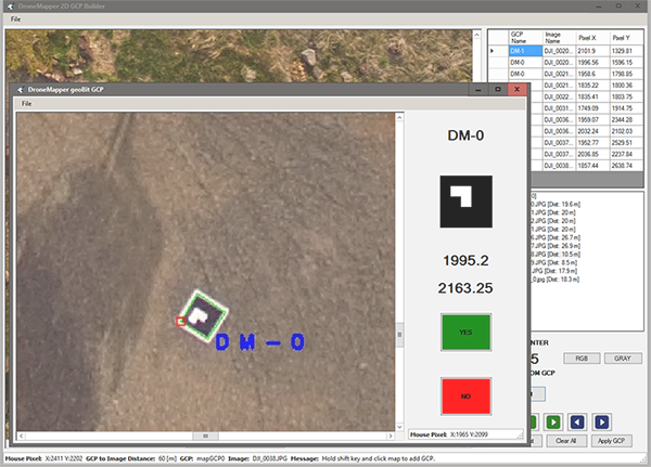
geoBits are automatically identified with our software, minimizing human introduced errors.
Proprietary computer vision algorithms to detect geoBit targets from a wide range of elevations and any camera.
The geoBit QA/GCP tool streamlines pre-processing workflows for the best possible results.
In addition to the physical geoBit targets, we've developed an advanced imagery pre-processing tool.
Filter imagery by area of interest, point in polygon, elevation and other QA methods.
Generate 2D to 3D GCP associations manually or with computer vision assisted functionality.
DroneMapper processing not required. Compatible with other photogrammetry systems and services.
Easy to use, export and understand TXT file output. Flight platform, camera and sensor agnostic.
![]()
![]()
Let us know if you have a question! We also design and develop custom target systems and computer vision software.